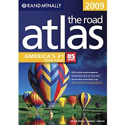
A Rand McNally road atlas is a great planning aid for an extended road trip. Scenic routes are designated with dotted lines, and parks and similar locations with camping facilities are denoted with the upside-down-V tent symbol.
A Rand McNally road atlas is a great planning aid for an extended road trip.
Scenic routes are designated with dotted lines, and parks and similar locations
with camping facilities are denoted with the upside-down-V tent symbol.
I mark the planned route with a yellow highlighter and then cut out the corresponding map pages. Later during the trip, the current active map page is placed in the tankbag's map holder for quick viewing.
Microsoft's Streets and Trips software is another useful aid for route planning. This software can also be used after the trip to document the journey. Map images from it can be uploaded to a web page.
A summary itinerary sheet is also prepared in advance. This is used as a rough guide during the trip to know if I'm on schedule, at least to within a few days.
Its purpose is not to enforce a rigid schedule but to help maintain an optimum pace. If the pace is too fast, the trip and all its fun would end before it should. Too slow, and an important commitment after the trip's scheduled end date may be missed.